Talking Map
Since 1992, the Gwich'in Social and Cultural Institute has been working with Gwich'in elders to build an inventory of heritage sites within the Gwich'in Settlement Region (GSR) through a traditional land use study using oral history and ethno-archaeological research. The oral history research has documented this knowledge and use of the land, by recording place names and associated stories, trails, traditional camp sites, graves, historic sites, harvesting locales, and sacred or legendary places.
To date, GSCI has recorded approximately 900 named places for the Gwich'in Settlement Region. There are two ways to explore and view Gwich’in place names. The first is an interactive cybercartographic map. This map allows the user to zoom in and out, click on names to read more information and see associated photos, and conduct searches. Downloadable place names maps are also available from the atlas.
The second way to explore and view Gwich’in place names is the "talking place name map," below. About 30 of the named places from our research are included, along three major rivers in the Gwich'in Settlement Region – Nagwichoonjik (Mackenzie River), Teetł’it Gwinjik (Peel River), and Tsiigehnjik (Arctic Red River). Through reading about the places along these rivers, long used as travel routes, you can learn more about the history and culture of the Gwich'in. Click on a river’s name to see the location of the places in the small map, and more information about each name below.
This name refers to an area at the northern end of the Caribou Hills. The hills in this area look like they have been scratched from top to bottom by giant fingers. Gwichya Gwich'in hunted caribou...
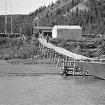
Reindeer Station was established by the Canadian Government in the early 1930's to manage the reindeer which had survived a five-year trek from Alaska to the east bank of the Mackenzie River Delta...
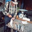
Aklavik elders Mary Kendi, Annie Benoit, Dolly McLeod, and Catherine Semple, have described this place as an important fishing area. Many different types of fish can be found here and runs of...
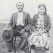
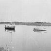
In the early 1950's, before Inuvik was built, the Roman Catholic brothers from the Aklavik Mission used to have a fish camp here. They fished here for the residential school and the mission dogs...
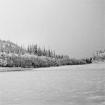
This name refers to a lobstick tree which once stood on a hill near the outlet of Gull Creek. These unique markers have long been used by the Gwich’in to mark important fishing locations, trails...
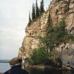
This place name refers to a prominent cliff on the eastern side of Campbell Lake, in the Gwich’in Territorial Park outside of Inuvik. The cliff is visible from the Dempster Highway and, if you...
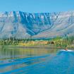
This name refers to a prominent mountain located southwest of the present-day community of Aklavik. There are many stories associated with this mountain including one about the legendary Gwich’in...
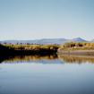
The Gwich’in name refers to the head of a summer trail up the Rat River which leads into the mountains where people hunted caribou and moose. It was the farthest point that people could travel by...
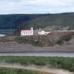
This name refers to three hollows located below the hill on which the Roman Catholic Church stands in Tsiigehtchic, near the confluence of the Arctic Red River and Mackenzie River. These hollows...

